About Volhynia
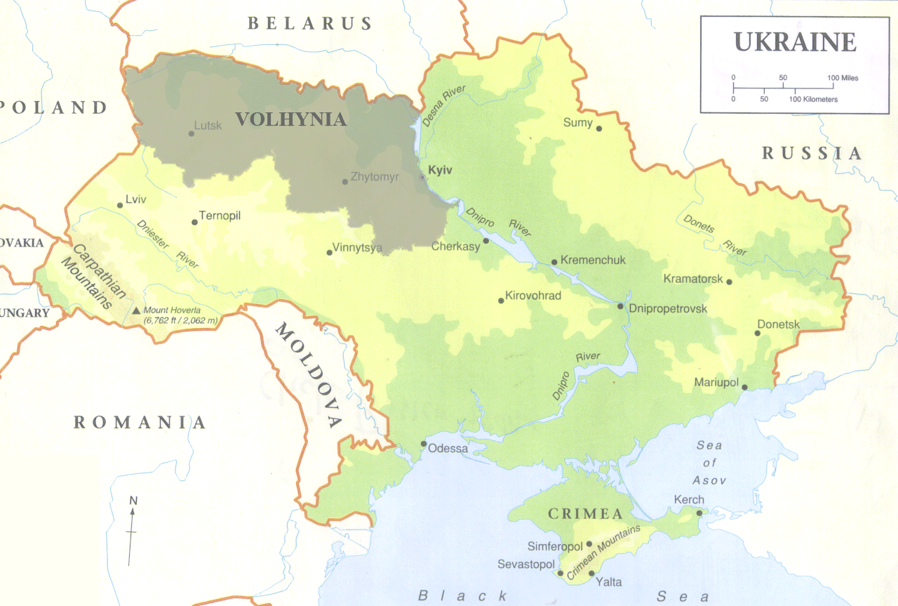 Volhynia is located in the northwest corner of Ukraine. It is one of 25 provinces in modern day Ukraine. It borders Poland in the west and Belarus (White Russia) in the north and runs east to the Dneiper River and then south roughly to Vinnitsia. The shaded area of the map shows the approximate borders of Volhynia compared to the rest of Ukraine. Technically, the province of Volhynia came into existence in 1797 when it came under Russian control following the third division of Poland. However, it existed long before then and has been occupied by several ruling powers since then.
In 1921 the Treaty of Riga split Volhynia in half. The eastern portion, beginning just west of Korez, went to Russia while the western part was taken over by Poland. In 1939/40 all of Volhynia came under Russian control and in 1991 Ukraine became an independent country and now has it own government.